The Museum as Archipelago
Anna-Sophie Springer
Published
I imagine the museum as an archipelago.
—Édouard Glissant
In 1948, the geography department at Harvard University was shut down for being “hopelessly amorphous” and for failing to produce “a clear definition of the subject” or to “determine its boundaries with other disciplines.” 1 This essay emerges from a much newer discipline, one that, in contrast to geography, has only just begun to exist as a proper academic field, but that is nevertheless enjoy ing its precocious status and attracting increasing theoretical inter est. Within the upstart discipline of “Curatorial Studies,” curatorial practice departs from the idea that curating historically entails car ing for artifacts within the institution, enabling the current dis course to turn its attention toward investigating and contouring forms of creative and critical agency, thus resulting in the production of knowledge with a performative element that has been called “the curatorial.” Like geography’s struggle for a convincing self-defini tion in the 1940s, curatorial practice today struggles with its own fluid boundaries. This fluidity, however, is the field’s strength; in what follows, I argue that far from being conceived of as a weakness, the openness of contemporary curatorial practice finds a retroactive and productive affirmation in the geographic and spatial theories that distinguish between settler and indigenous cartographies. 2
Machining Knowledge
The island was spread out under their eyes
like a map, and they had only to give names
to all its angles and points.
—Jules Verne
Most fundamentally, a map is an eidetic—visual, but also mental—representation
of an area. Such a form of representation is connected to an activity of production,
including navigational devices and models of surroundings, that is nearly as old as recorded history. 3 But maps, whether we
look at Roman, Greek, Chinese, or early European explorers, have also been important “weapons of imperialism” 4 and “tools for projecting power-knowledge,” 5
enabling and expanding the scope and violence of countless colonial endeavours.
In fact, it was during the colonial scramble of the nineteenth century that “a pen across a map could determine the lives and deaths
of millions of people.” 6 In this instance, the map both anticipated and actualized
processes of human cultural intervention, rendering them conceivable and actionable. Despite this material actualization, however, it is important to stress that maps
are, in a large part, fictions of factual conditions; as human-made interpretations of the world, they foreground certain elements while leaving out others. What this means is that a map is not simply a mirror
image of the world but a creation with “semantic, symbolic and instrumental” content. 7Therefore, maps do not represent anything;
instead, they produce effects by organizing knowledge and constructing perspectives. They are performative tools that can both frame and undo territories; read optimistically, every map has the potential to produce a new and different world.
One such example is R. Buckminster Fuller’s “Dymaxion Map” of 1943. While
our common Mercator projection privileges Europe and North America through orientation and distortion, Fuller’s projection unfolds the earth into a poly-directional
icosahedron, depicting the seven continents as a chain of islands (“one island
earth”) and the oceans as a connected,
fluid mass. The triangles of the map can be rotated towards each other in differ
ent ways, each time offering a radically different but always valid configuration,
making the Dymaxion Map a rare specimen of a world map that does not depend
on a predetermined perspectival centre. 8
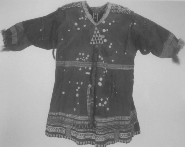
Koryak Dancing Coat made of reindeer skin. The bleached disks symbolize the stars and constellations of seasonal skies, the waistband
the summer Milky Way. Image from David Woodward and G. Malcolm
Lewis, eds.,
Cartography in the Traditional African, American, Arctic,
Australian, and Pacific Societies, Vol. 2, Book 3, (Chicago: University
of Chicago Press, 1998): Plate 14.
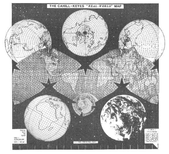
Draft version of Cahill-Keyes “Real-World” Map, 1984. Actual scale of original digital image is 1/100 million. This map is adapted from B.J.S. Cahill’s octahedral “Butterfly” projection, published in 1909. The graticule was newly devised, computed, and drawn by Gene Keyes in 1975, along with the coastlines, boundaries, and overall map design. Image courtesy of Gene Keyes.
It is exactly this kind of approach to mapping that Deleuze and Guattari encourage
in their ground-breaking text “Rhizome,” in which they use the concepts of map
and rhizome almost interchangeably over
several passages:
Make a map not a tracing! [...] What distinguishes the map from the tracing is that it is entirely
oriented toward an experimentation in contact with the real. [...] The map is open and connect able in all of its dimensions; it is detachable, re
versible, susceptible to constant modification. It can be torn, reversed, adapted to any kind of mounting, reworked by an individual, group, or social formation. [...] The map has to do with performance, whereas the tracing always involves
an alleged “competence.” 9
According to Deleuze and Guattari, a tracing is nothing more than a reductive
reproduction of given assumptions. Making a map, on the other hand, becomes a
productive and often physical engagement with a territory that conditions the rhythmic relations of time and space.
Deleuze and Guattari’s laudatory estimation of the practice of mapping finds ample support within the history of cartography. The Polynesian stick chart, for example, emphasizes subjectivity, embodiment, direct experience, and connectivity. Used at least until the end of World
War II to canoe from atoll to atoll and island to island in the Marshall Islands region of the Pacific Ocean, these maps were constructed as open frameworks
from coconut fronds and tiny seashells to symbolize ocean swells, and the wave and crest patterns of the ocean surface. Made by the navigators themselves, these maps reflected their individual, physical experience in the open sea, varying so much in interpretation and form that they were readable solely to the author-cartographer.
Contrary to many other navigation techniques, the charts were not taken along on
the trips but studied and memorized prior to departure, and the navigator would lie
down in the canoe during the voyage to
feel how the boat was moved about by the underlying ebb and flow. While this practice makes the map a bio-geographical tool, rendering it personal and idiosyncratic, it nevertheless suggests that these personal cartographies were crucial devices for creating a network of inter-island
communication. 10
Voyages and Charts
Perhaps there never was a very first voyage that scattered the seeds of human habitation in the world’s space.
But we do know of the last of them, of poles conquered, deserts crossed, wild
erness invaded. This is the end of all
voyages. All possible encounters have been accomplished, undertaken, ended, foreclosed. The cycle is completed,
the map of the earth has covered the earth. Space is inscribed upon the charts. The globe is perceived as a ball
in a net of latitudes and longitudes.
—Michel Serres
The tension between “voyages” and “charts” is well documented by David Neufeld, a
historian of the Western Arctic and Yukon Territory. His text “Learning to Drive the
Yukon River: Western Cartography and Athapaskan Story Maps” examines how
artifacts and landscapes necessarily embody different, possibly conflicting, cultural narratives, and questions how to deal with these differences productively.
Through his estimation of cartographic difference, the practice of the curator finds especially valuable clues. By remaining particularly sensitive to the idea that different peoples’ stories and histories
“have shaped the way they experience, understand, and respond to the physical
world,” 11 curators can unfold new relations to previously discounted modes of
knowledge production and dissemination, and the values that attend to them.
Neufeld uses a comparison between settler and native mapping techniques from
the Dawson City region as a means to discuss issues of identity and cultural and environmental coexistence in the area
of the Yukon River. The quintessential experience that he recounts from his field
work revolves around the oral instructions given to him from an indigenous elder on
how to navigate the site of his historical and anthropological research. When consulted, the man uses a stick to scribble a
pattern of a crucial part of the Yukon River—a conglomeration of sandbars and islands—into the ground.

“Victor Henry’s Map, July 2006,” photo
of the yard which the river man dabbled
with his stick to explain the moving is-
lands to historian David Neufeld. Photo:
David Neufeld
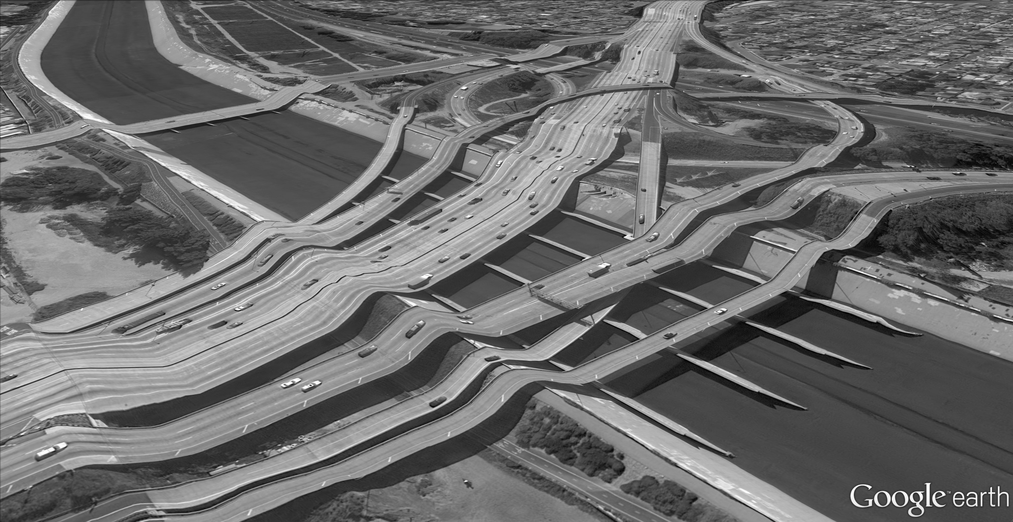
Clement Valla, “Postcards From Google Earth
(33°52'37.41"N, 118°11'22.05"W)”; courtesy the artist.
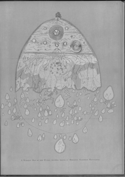
A Burmese map of the world, showing traces of Medieval European map-making. From R.C. Temple, The Thirty-Seven Nats: A Phase of Spirit-Worship Prevailing in Burma
[1906]. Chromolithograph.
Asian and Middle Eastern Division, The New York Public Library, Astor, Lenox and Tilden Foundations.
To the historian, these signs are as cryptic as the advice he is sent
on his way with: “Just watch [the island in front of you], when it starts to move, turn
and head towards the next island. [...] And when that island starts to move, turn away and you’re through.” 12 When Neufeld and
his team reach the area by boat the sandbars do indeed appear, shift, and disappear
in the water. But by following the instructions the boat actually makes it through
the tricky area without running aground. In retrospect, Neufeld tries in vain to
find a rational explanation for the encountered phenomena and states instead that
the elder’s experiential description is less about objective investigation than “about journeys and the relationships exercised
during travel.” 13 While the First Nations
river man’s story-map of “moving islands”
conveys his knowledge as conditioned by a participatory relationship with the land
(in the sense of a “co-production of a shared world”), the settler approach is historically grounded in scientific, mathematical data
collection and guided by the endeavour to master the surrounding world; it is detached
through an aerial perspective and oriented toward future outcomes such as “settlement, development, and production.” 14 While the Indigenous map is based on an engagement with a particular place in a specific time,
creating a sense of vibrant geography actualised through the act of travelling, settler cartography assumes that the objects
in the world are real when they are objective and independent from the cartographer, leading to maps that are “ethnocentric images [...producing] an empty land [...] of unexploited resources and opportunity.” 15
This notion of neutrality is, of course, an illusion that relies on a colonial ideology.
Since the mid-nineteenth century, the longitudes and latitudes of the common, abstract grid have been modelled according to physical space/time synchronization with the chronometer on the Greenwich prime meridian at the Royal Observatory in London. The grid is thus a direct historical outcome
of colonial British maritime power; instead of territorial neutrality, the settlers’ maps ultimately bear within them an emblem of
violent colonial conquest.
Like maps, curatorial projects are social constructions—“narrative spaces”—that
shape our understanding of place and space. In Boris Groys’ estimation, “Every exhibition tells a story by directing the viewer through the exhibition in a particular
order; the exhibition space is always a narrative space.” 16 From this perspective,
we can see how Neufeld’s description of the two histories of map-making also suggest two approaches to curatorial practice.
If traditional museums have organized artifacts according to a particular history—in fact, using the artifacts to support and represent that very history and construct
a particular identity 17—contemporary curatorial practice can work to become more vulnerable and attentive to radically different, and differentiated, decisions and actions that create meaning and place. This
trajectory finds a compelling resonance with Deleuze and Guattari’s concept of a
“smooth” space, particularly when curatorial projects are designed as “an amorphous
collection of juxtaposed pieces that can be joined together in an infinite number of ways.” 18 Operating from within the tentative territory of a smooth space, a curator cartographer can partake in making palpable worlds moved by fluxes and intensities more than by clear-cut, easy-to-grasp
subject-object relations.
Moving Islands
The matter at hand is: things that resist discourse, things that cut our
tongues, and for which we have no words—things whose only spectator
is savage.
—Vincent Normand
The exhibition Journeys: How Travelling Fruit, Ideas and Buildings Rearrange Our Environment, held at the Canadian Centre for Architecture in 2010–2011, is an exemplary case of a curatorial approach that amorphously juxtaposed a number of different spaces—a thematic exhibition with different rooms and sub-topics, a
book composed of theory disguised as
short stories, a web platform and a series of live events—while fostering a sense of
both navigational openness and conceptual connectedness. Curated by Giovanna
Borasi and designed by Martin Beck, Journeys confronted the phenomenon of global
transformation and hybridization precisely by examining the production of space
through displacement, dislocation, and movement.

“A Map of Vesuvius Showing the Directions of the
Streams of Lava in the Eruptions from 1631 AD to
1831 AD,” John Auldjo,
Sketches of Vesuvius: With
Short Accounts of its Principal Eruptions, From the
Commencement of the Christian Era to the Present
Time
(Naples: G. Glass, 1832). Houghton Library
Harvard University, Cambridge, Mass.

James Cook, “A Plan
of King Georges Island
or Otaheite Lying in the
South Sea, by Lieutenant I.
Cook; Discovr’d by Captn.
Wallice the 19th June,
1767.” Rare Map Collec
-
tion of the State Library
of North South Wales,
Sydney.
Borasi and her curatorial team considered how our physical surroundings
are incessantly subjected to exchange processes occurring across architectural, environmental, and geo-political planes, triggering material changes which ultimately feed back into shaping the realities of the people affected. In order to invite
visitors to navigate this assemblage, the exhibition was organized as a compilation of 15 thematic narrative zones visually
distinguished by a colour scheme and mapped out according to a glossary of 15
concepts serving as frames for the case studies. The exhibits themselves included
a diverse array of archival documents, museological and mundane objects, antique
books, maquettes, maps, plans, videos, illustrations, art photography and, faithful to its title, even a coconut drifting through
ocean currents. It was through this diversity and unconventional composition that the
exhibition could provoke discoveries based on tensions, correlations, and curiosities.
While Deleuze and Guattari were developing their innovative spatio-philosophical concepts of smooth and striated space in A Thousand Plateaus, the difference between the ideology of the modernist White Cube (as articulated by Brian
O’Doherty) and the decentring strategies of Lucy Lippard (based on the work of Dan
Graham and Robert Smithson, among others) was being argued in the realms of art theory and scholarship. Echoing the
critique of the illusionary construction of settlers’ maps, O’Doherty argued in a series
of essays published in Artforum that the White Cube of the modernist gallery space is built upon an illusion of neutrality: “The
white wall’s apparent neutrality is an illusion. It stands for a community with common ideas and assumptions. [...] The development of the pristine, placeless white
cube is one of modernism’s triumphs—a development commercial, esthetic, and technological.” 19 Accordingly, the art displayed in the context of this “void” is set apart from the world and can seemingly
take on its own life, existing independently from social, historical, or political
contingencies
. What really is the case, however,
is that the architecture of the cube becomes a frame—a grid structure—that signifies
the affirmation and unification of certain ideas and values by excluding a great number of others. This exclusionary aspect is something the feminist thinker and
curator Lucy Lippard has confronted in her curatorial work. Reminiscent of the
“vibrant geography” acknowledged and produced through indigenous mapping
techniques, Lippard’s practice sees sites and places as crucial elements of meaning
ful art practice. In her words, “Art that illuminates its location rather than just
occupying it is place-specific [...], incorporating
people and economic and historical forces as well as topography. It usually ‘takes place’ outside of conventional venues that entice audiences
through publicity and fashion. It is not closeted in ‘white cubes,’ accessible only when admission is paid or boundaries are breached. It is not
readable only to those in the know. [...] It makes places mean more to those who live or spend
time in them.” 20 Like in the two types of mapping described by Neufeld, or the concepts of smooth and striated space in Deleuze and Guattari, the difference for Lippard is signalled by her emphatic refusal of the alleged objectivity
or neutrality of the gallery space.
In comparing the roles of the cartographer and the curator, we might now ask
more directly: what does Antillean philosopher Édouard Glissant mean when he
says, “I imagine the museum as an archipelago”? Essential to Glissant’s notion of
the archipelago is the idea of a fragmented territory that cannot be reconciled under
a collective identity but which instead must accept individual identities as the
diverse multiplicities which they always are. Like a Dymaxion Map, a “moving islands” story map, or a Polynesian stick
chart, the curator operates on the institution to make it leak; curatorial practice, as
a cartography of thefluid,works to create a decentred space that does not operate according to absoluteness, objectivity, or synthesis, but rather invites a multiplicity
of interconnections brought about by conjecture, memory, sensation, excess, and
reflexivity. In moving toward this curatorial invitation, we could do worse than to appropriate James Corner’s description of
mapping as our own cartographic guide:
As both analogue and abstraction, then, the surface of the map functions like an operating table, a staging ground or a theatre of operations upon which the mapper collects, combines, connects, marks, masks, relates and generally explores.
These surfaces are massive collection, sorting and transfer sites, great fields upon which real
material conditions are isolated, indexed and
placed within an assortment of relational structures. 21
If the curator acts as a cartographer, then mapping becomes her technique, and the
map can be understood as the product of her work. This would not be limited to floor
plans, didactics, or curatorial statements; such a method is inclusive of the curatorial practice as a mode of knowledge production. In other words, the curator as
cartographer establishes an attitude towards the world that partakes in making
the world. Like a voyage through interminably moving islands, curatorial practice, to be effective as a navigational practice,
would necessarily become vulnerable to physical contact, improbable exchange,
and collaborative experimentation; such vulnerabilities would undoubtedly lead the curator far from the safety of the illusory horizons of representation, which is all the better for her construction of fictions, both real and imagined.
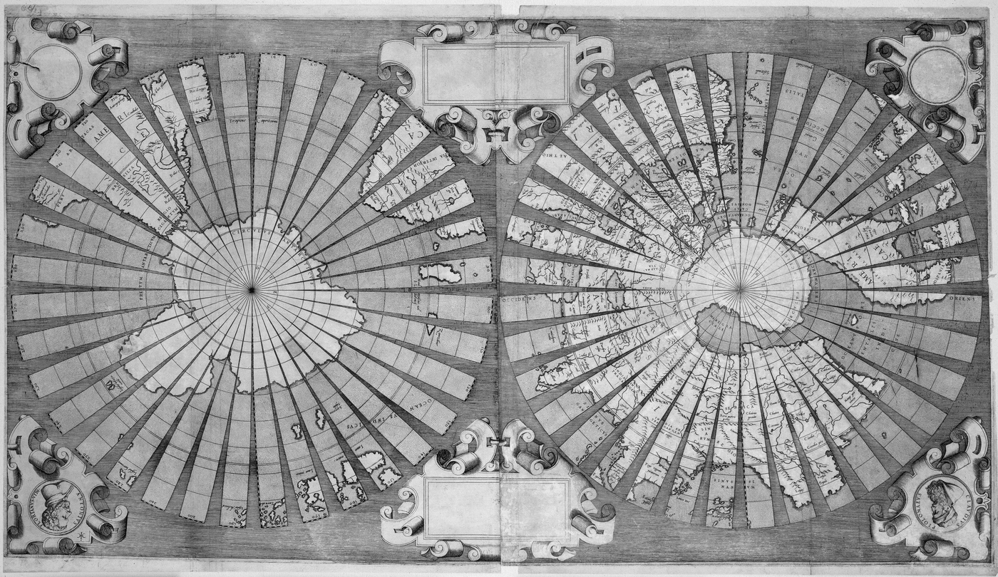
Untitled world map on a double hemisphere polar
projection with each hemisphere drawn onto 36
gores by Antonius Florianus, estimated before
1566. Rare Map Collection of the State Library of
North South Wales, Sydney.
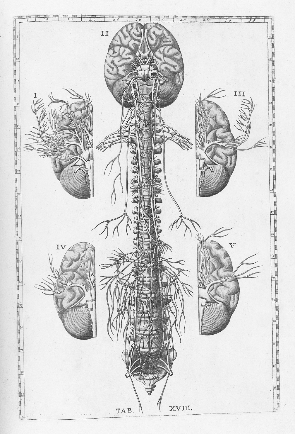
Bartholomeo Eustachi, Tabulae anatomicae, Table
18, engraved anatomical plates, 1783. US National
Library of Medicine, Bethesda, MD.
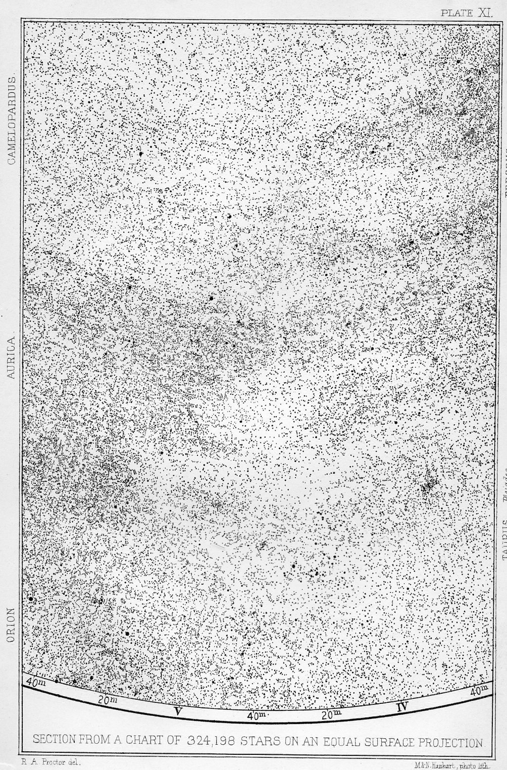
“Plate XI: Section from a Chart of 324,198 Stars on an Equal Surface Projection”
from Richard A. Proctor, “Statement of Views Respecting the Sidereal Universe,”
Monthly Notices of the Royal Astronomical Society
33, no. 6 (1873): 547.
Bio
Anna-Sophie Springer co-directs K. Verlag, an independent press exploring the book as a site for exhibitions, in Berlin. She has an MA in Contemporary Art Theory from Goldsmiths College London and is currently completing the programme “Cultures of the Curatorial,” Academy of Visual Arts, Leipzig. She has worked for several years as an editor at the pioneering German theory publisher Merve Verlag, where she is editing a forthcoming collection of texts on art by Hélène Cixous. She also works as an independent curator and is a 2013 member of SYNAPSE, the International Curators’ Network at
Haus der Kulturen der Welt, Berlin. Besides many contracts as editor and translator in the art field, her essays and interviews have appeared in C Magazine, Fillip, Rheinsprung11, and Scapegoat.