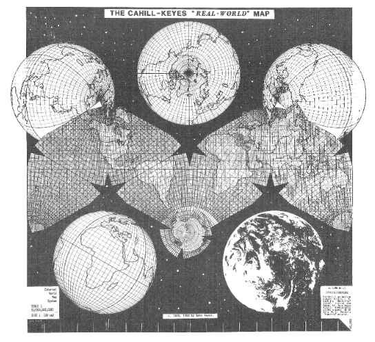
Draft version of Cahill-Keyes “Real-World” Map, 1984. Actual scale of original digital image is 1/100 million. This map is adapted from B.J.S. Cahill’s octahedral “Butterfly” projection, published in 1909. The graticule was newly devised, computed, and drawn by Gene Keyes in 1975, along with the coastlines, boundaries, and overall map design. Image courtesy of Gene Keyes.